
Project Zero is the fixed 0 mm height reference of a Dravit project. It is a project-relative coordinate, not a surveyed site elevation. A Level's Elevation from Project Zero is a signed distance: positive above the reference, negative below it. Project Zero is not an editable Level or a physical floor.
Read the heights in a side view
Select Front, Back, Left or Right in 2D to see the Project Zero line and any Levels. In this Willow House example, Foundation is at −1200 mm, Ground floor at 0 mm, First floor at 3000 mm, and Roof datum at 6000 mm. Foundation is 1200 mm below Project Zero; Roof datum is 6000 mm above it. These values describe the example's model, not required heights for another project.
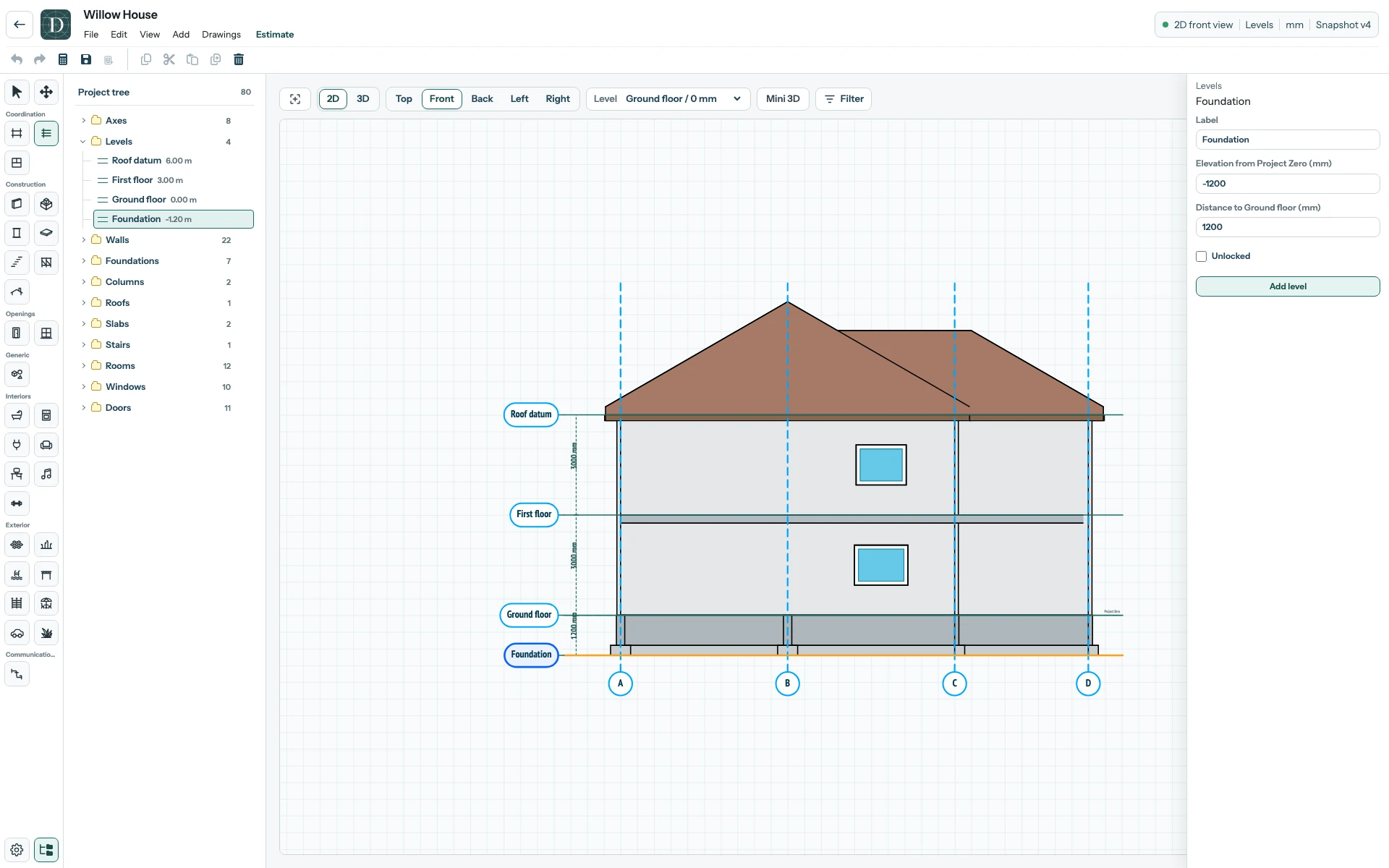
View the full-size Levels screenshot.
Distinguish zero from a Level
Ground floor happens to share the 0 mm height with Project Zero. It remains a separate Level you can select and edit; the Project Zero line stays as the reference. It appears even in a new project with no Levels. Create the first Level to see both states.
A Level establishes a height reference; it does not create a slab, foundation or roof. See how the building shell uses Levels.